
Projects consist of one or more plot observations, i.e. sample sites with attached information.
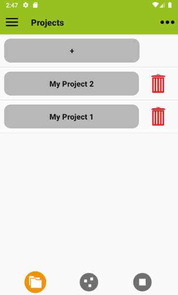
In the list of projects on the start screen, you can add projects using the plus button. You will be asked to enter a project name, a settings profile and a layer system. The profile determines which attributes are shown, the layer system defines how your site obervation is organized in strata or layers. The profile and layer system are derived from templates, but are then project-specific. The selection of attributes in the profile can be changed later, as can the selection of layers in the selected layer system. However, the layer system as a whole cannot be changed later.
Project names can be edited by long-pressing the respective grey button. You can delete a project from the list by tapping on the red trash can next to it. Importing, exporting and exchanging projects is done via the menu (Projects > Import, > Export, > Send). More details can be found in the data exchange section.
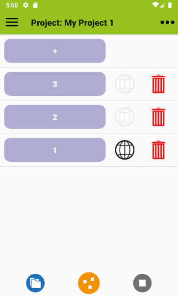
A single project page contains a list of plot observations. Plot observations can be added using the plus button and removed using the red trash can. Plot names are edited in the plot section.
You can try to display a map of plot locations by tapping one of the globe icons on a project page. This should open a map with markers (if there are coordinates stored with the plots). Tapping a marker on the map will take you to the corresponding plot observation. The map view requires an active internet connection or a cached map (the maps for mobile help shows how to cache maps). The globe icons in the plot list are greyed out if the plot has no coordinates.